Author: yan
-
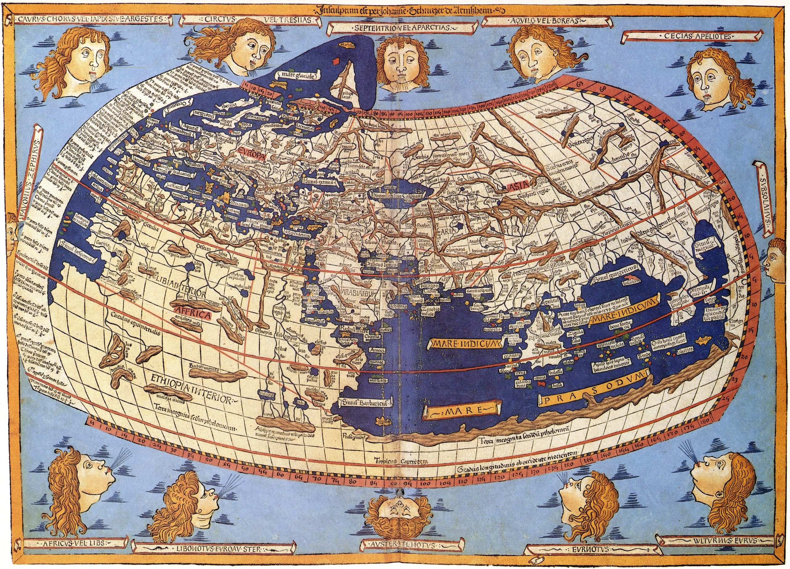
Cartography
Cartography () is the study and practice of making and using maps. Combining science, aesthetics and technique, cartography builds on the premise that reality (or an imagined reality) can be modeled in ways that communicate spatial information effectively. The fundamental objectives of traditional cartography are to: Set the map’s agenda and select traits of the…
-
Remote sensing
Remote sensing is the acquisition of information about an object or phenomenon without making physical contact with the object, in contrast to in situ or on-site observation. The term is applied especially to acquiring information about Earth and other planets. Remote sensing is used in numerous fields, including geophysics, geography, land surveying and most Earth…
-
Geographic information system
A geographic information system (GIS) consists of integrated computer hardware and software that store, manage, analyze, edit, output, and visualize geographic data. Much of this often happens within a spatial database; however, this is not essential to meet the definition of a GIS. In a broader sense, one may consider such a system also to…
-
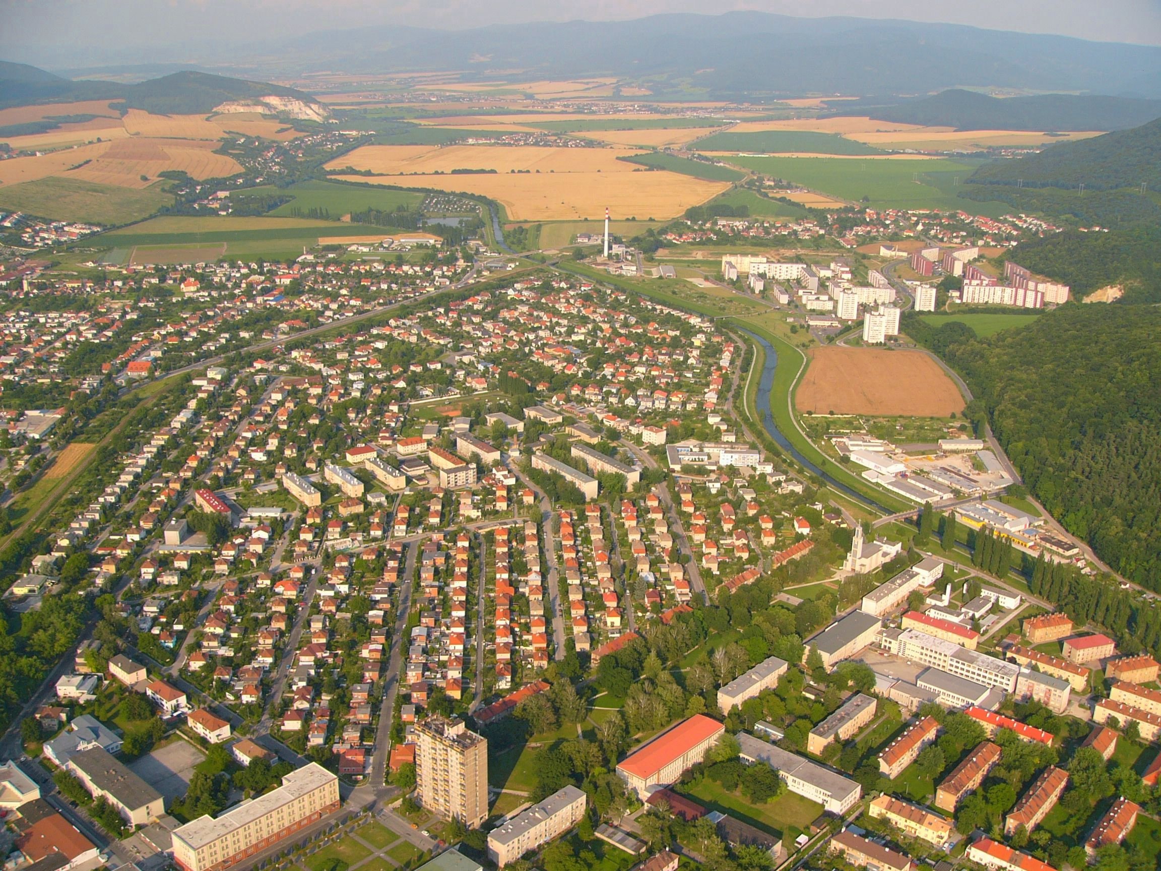
Urban informatics
Urban informatics refers to the study of people creating, applying and using information and communication technology and data in the context of cities and urban environments. It sits at the conjunction of urban science, geomatics, and informatics, with an ultimate goal of creating more smart and sustainable cities. Various definitions are available, some provided in…
-
Urban planning
Urban planning (also called city planning or town planning in some contexts) is the process of developing and designing land use and the built environment, including air, water, and the infrastructure passing into and out of urban areas, such as transportation, communications, and distribution networks, and their accessibility. Traditionally, urban planning followed a top-down approach…
-
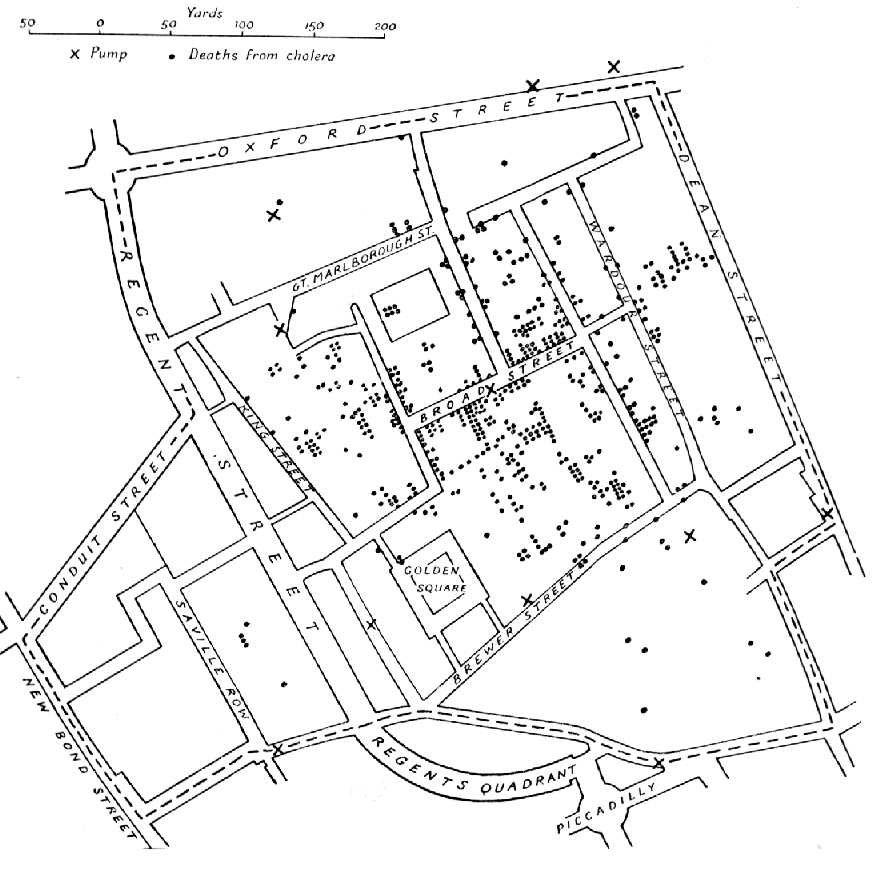
Urban science
Urban science is an interdisciplinary field that studies diverse urban issues and problems. Based on research findings of various disciplines such as history, economics, sociology, administration, architecture, urban engineering, transportation engineering, landscape architecture, environmental engineering, and geo-informatics, it aims to produce both theoretical and practical knowledge that contributes to understanding and solving the problems of…
-
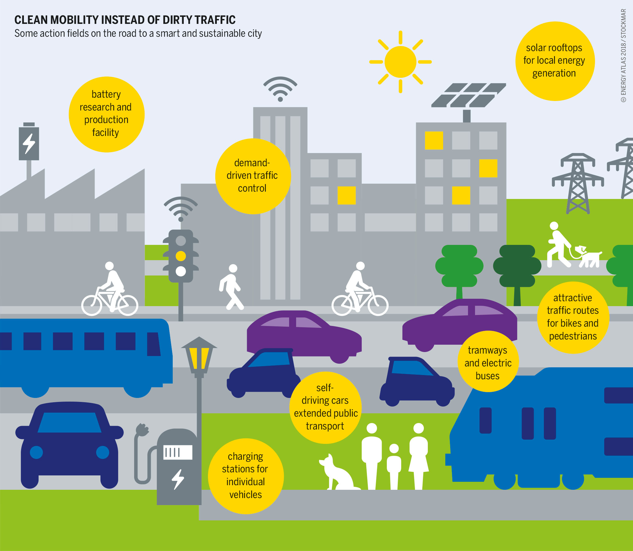
Smart city
A smart city is an urban model that leverages technology, human capital, and governance to improve sustainability, efficiency, and social inclusion, which are considered goals for cities of the future. Smart cities use digital technology to collect data and operate services. Data is collected from citizens, devices, buildings, or cameras. Smart city applications are diverse…
-
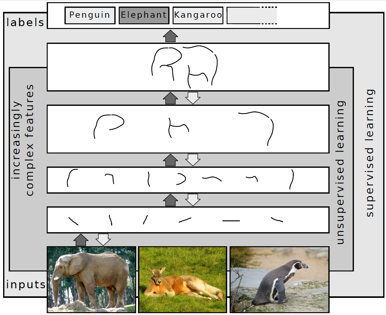
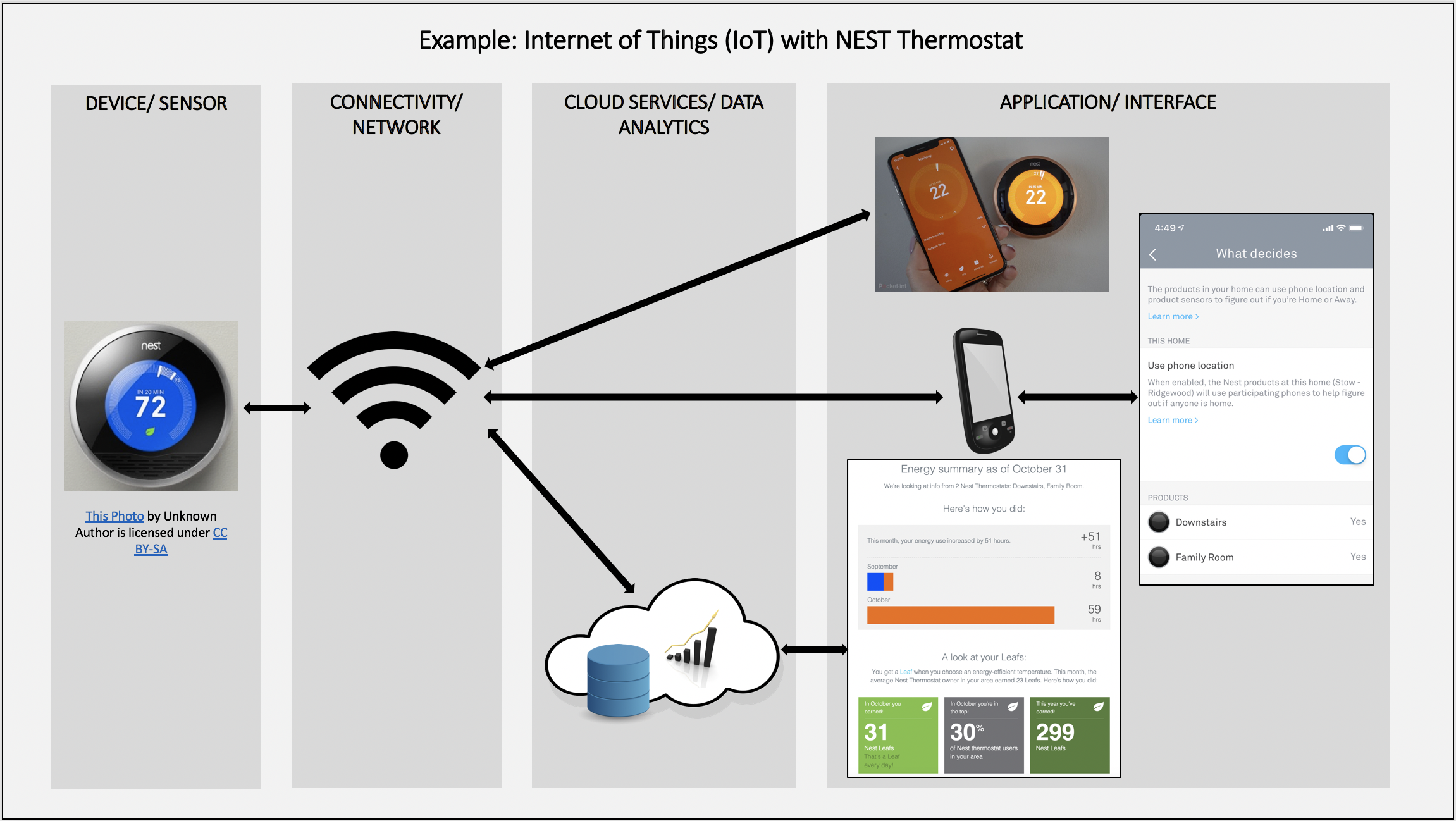
Urban computing
Urban computing is an interdisciplinary field which pertains to the study and application of computing technology in urban areas. This involves the application of wireless networks, sensors, computational power, and data to improve the quality of densely populated areas. Urban computing is the technological framework for smart cities. The term “urban computing” was first introduced…
-