Urban Science
-
Urban informatics
Urban informatics refers to the study of people creating, applying and using information and communication technology and data in the…
-
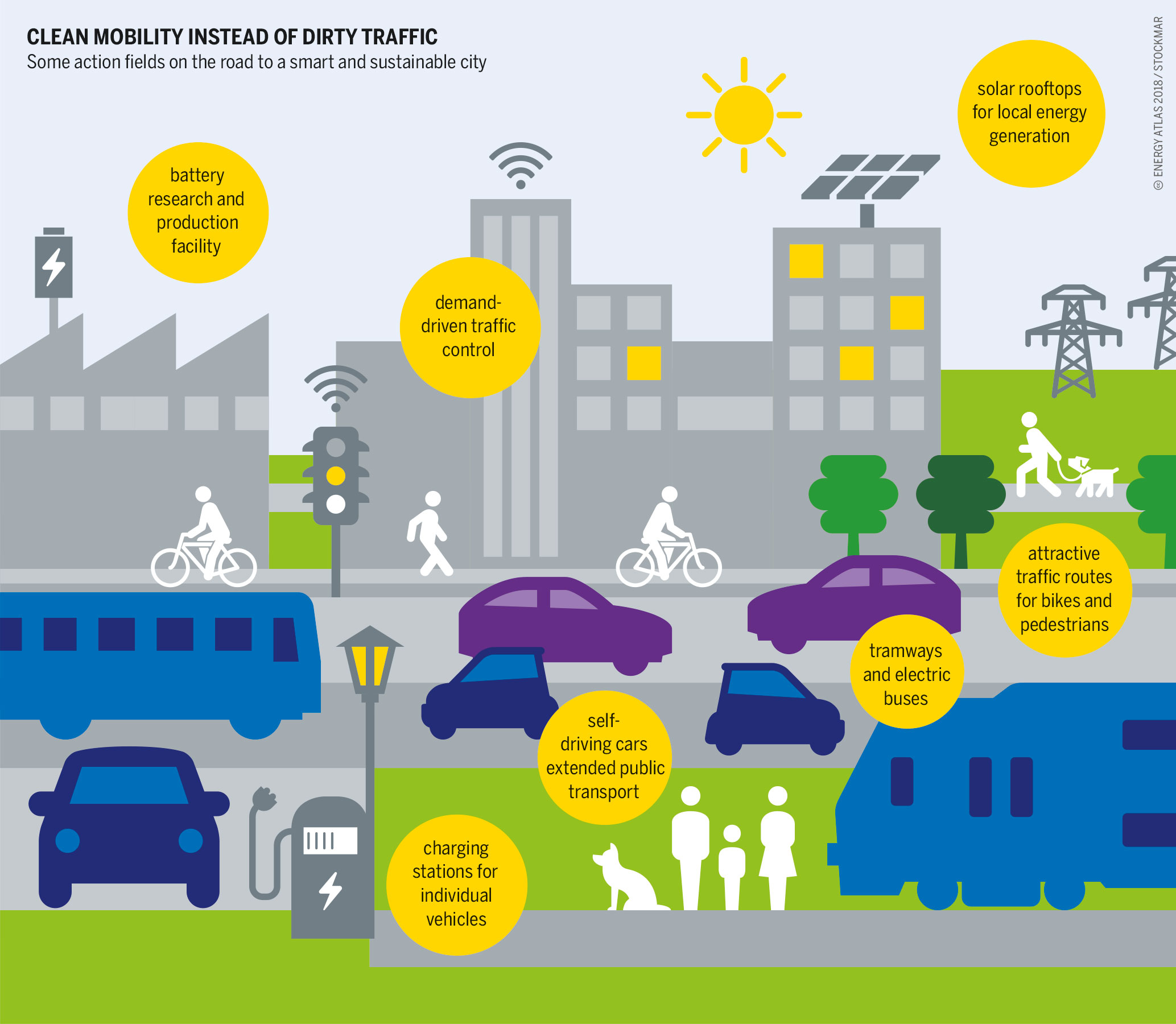
Urban planning
Urban planning (also called city planning or town planning in some contexts) is the process of developing and designing land…
-
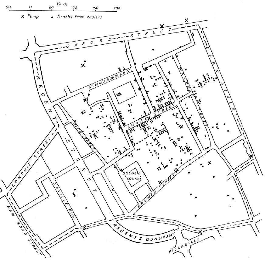
Urban science
Urban science is an interdisciplinary field that studies diverse urban issues and problems. Based on research findings of various disciplines…
Geospatial Tech
-

Cartography
Cartography () is the study and practice of making and using maps. Combining science, aesthetics and technique, cartography builds on…
-
Remote sensing
Remote sensing is the acquisition of information about an object or phenomenon without making physical contact with the object, in…
-
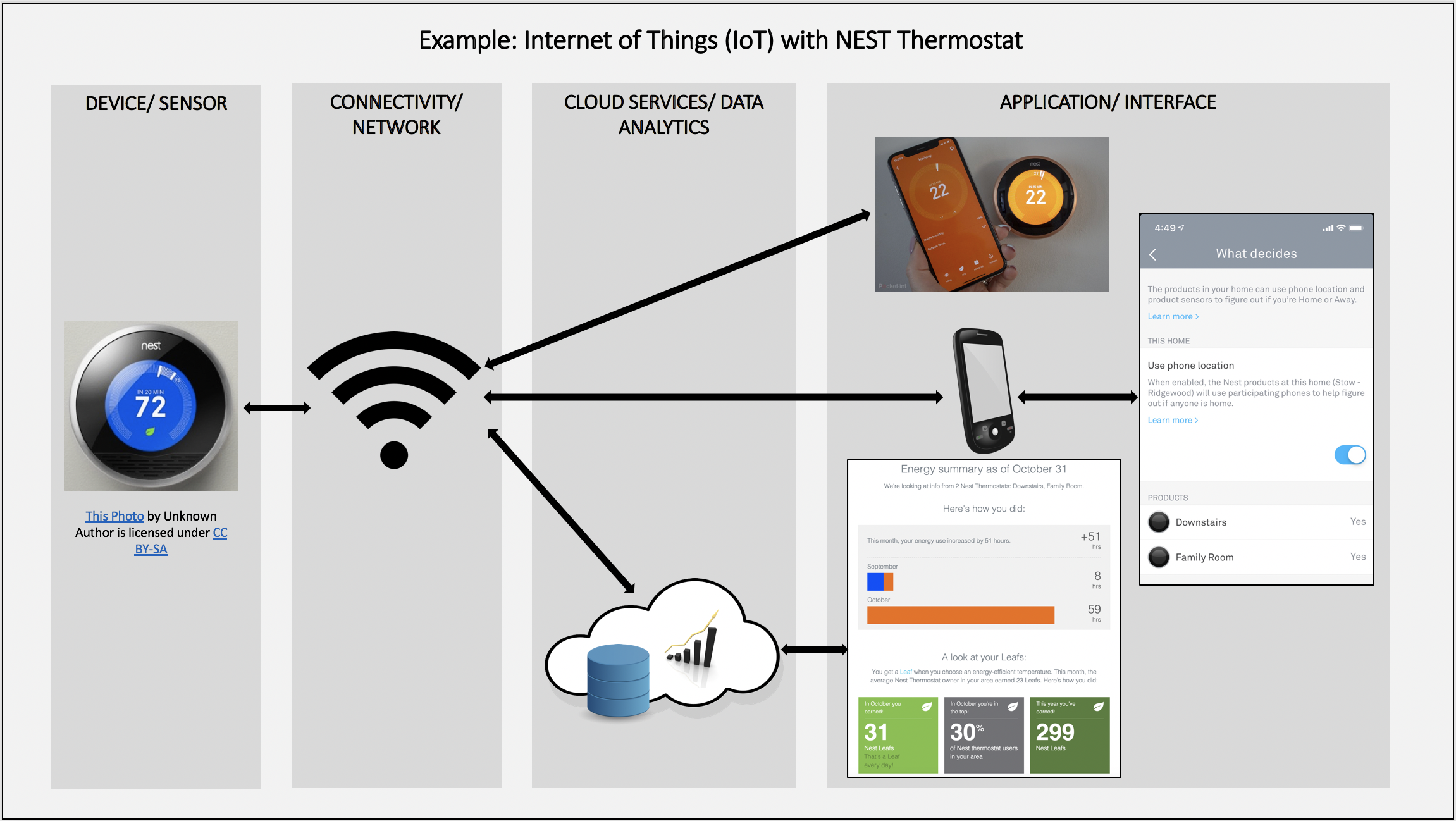
Geographic information system
A geographic information system (GIS) consists of integrated computer hardware and software that store, manage, analyze, edit, output, and visualize…
AI & Data
-
Natural language processing
Natural language processing (NLP) is the processing of natural language information by a computer. NLP is a subfield of computer…
-
Large language model
A large language model (LLM) is a language model trained with self-supervised machine learning on a vast amount of text,…
-
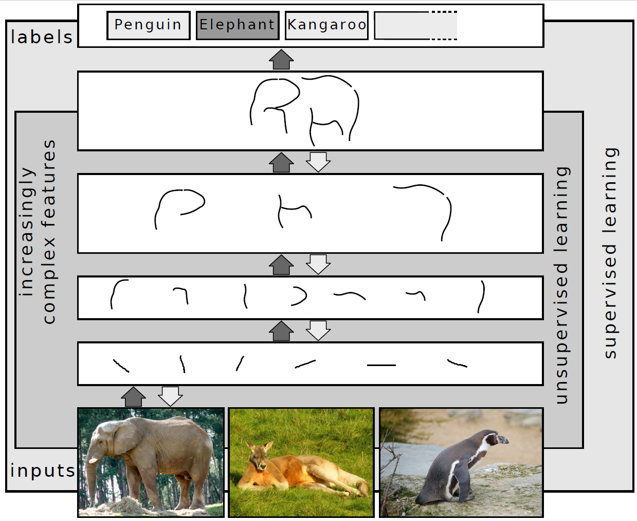
Deep learning
In machine learning, deep learning focuses on utilizing multilayered neural networks to perform tasks such as classification, regression, and representation…