Future of Urban Intelligence
Explorations in Geo-Spatial AI and Digital Twins
Urban Science
-
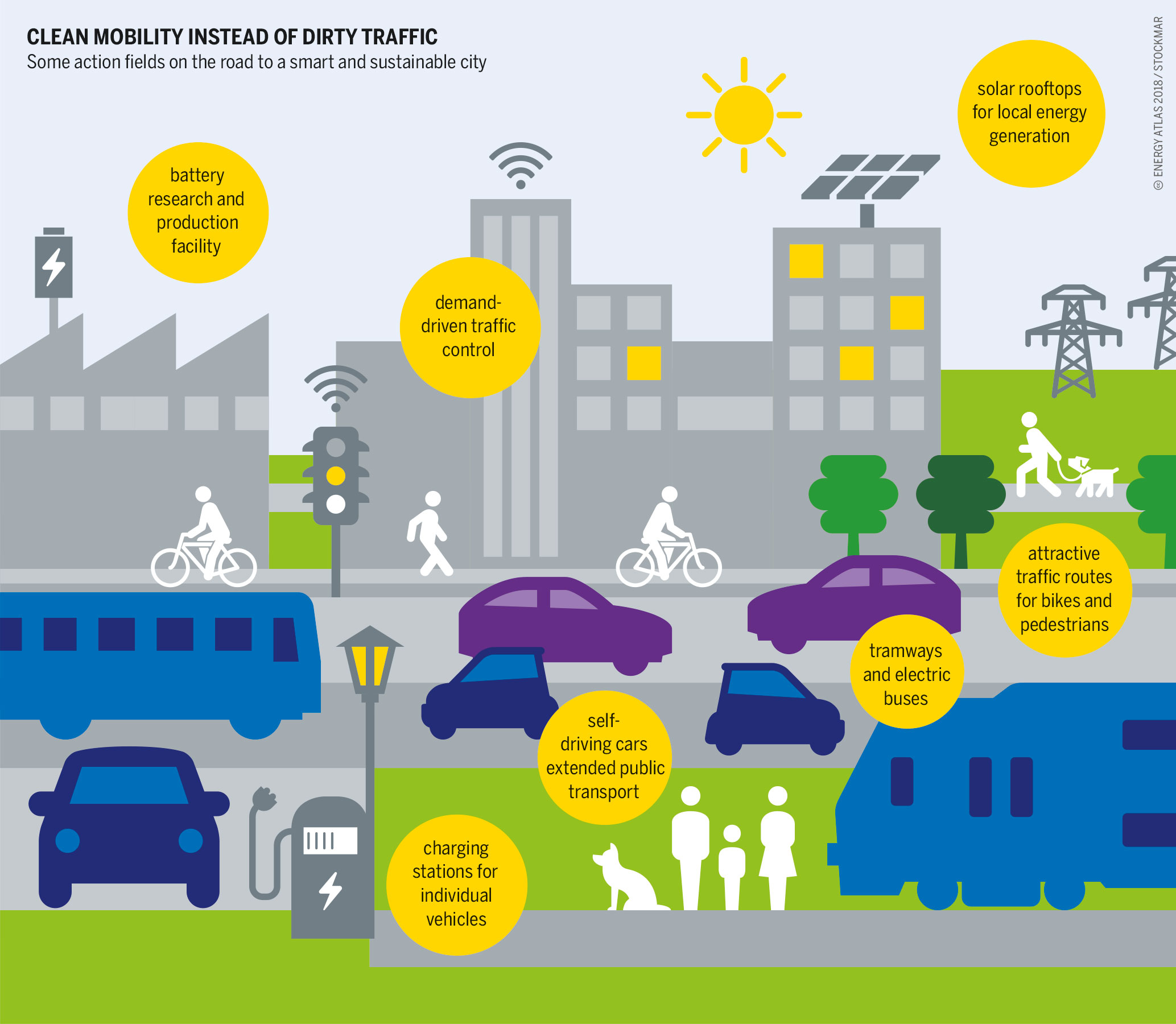
Urban informatics
Urban informatics refers to the study of people creating, applying and using information and communication technology and data in the context of cities and urban environments. It sits at the conjunction of urban science, geomatics, and informatics, with an ultimate goal of creating more smart and sustainable cities. Various definitions are available, some provided in…
-
Urban planning
Urban planning (also called city planning or town planning in some contexts) is the process of developing and designing land use and the built environment, including air, water, and the infrastructure passing into and out of urban areas, such as transportation, communications, and distribution networks, and their accessibility. Traditionally, urban planning followed a top-down approach…
-
Urban science
Urban science is an interdisciplinary field that studies diverse urban issues and problems. Based on research findings of various disciplines such as history, economics, sociology, administration, architecture, urban engineering, transportation engineering, landscape architecture, environmental engineering, and geo-informatics, it aims to produce both theoretical and practical knowledge that contributes to understanding and solving the problems of…
Geospatial Tech
-
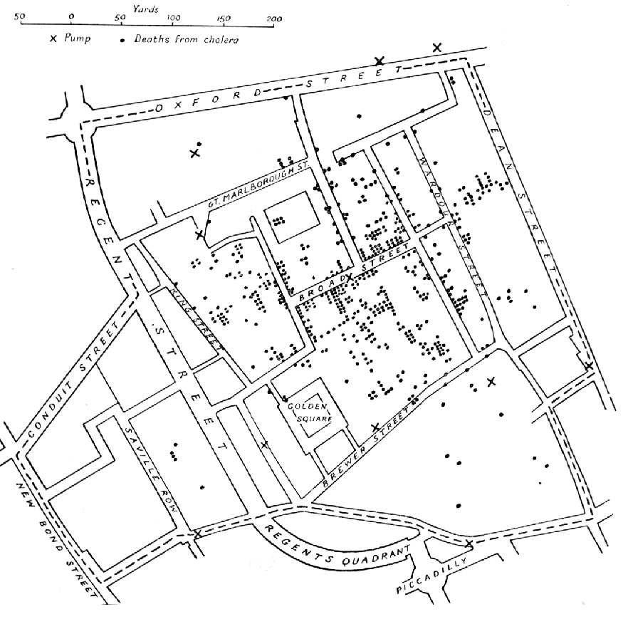
Spatial analysis
Spatial analysis is any of the formal techniques which study entities using their topological, geometric, or geographic properties, primarily used in urban design. Spatial analysis includes a variety of techniques using different analytic approaches, especially spatial statistics. It may be applied in fields as diverse as astronomy, with its studies of the placement of galaxies…
-
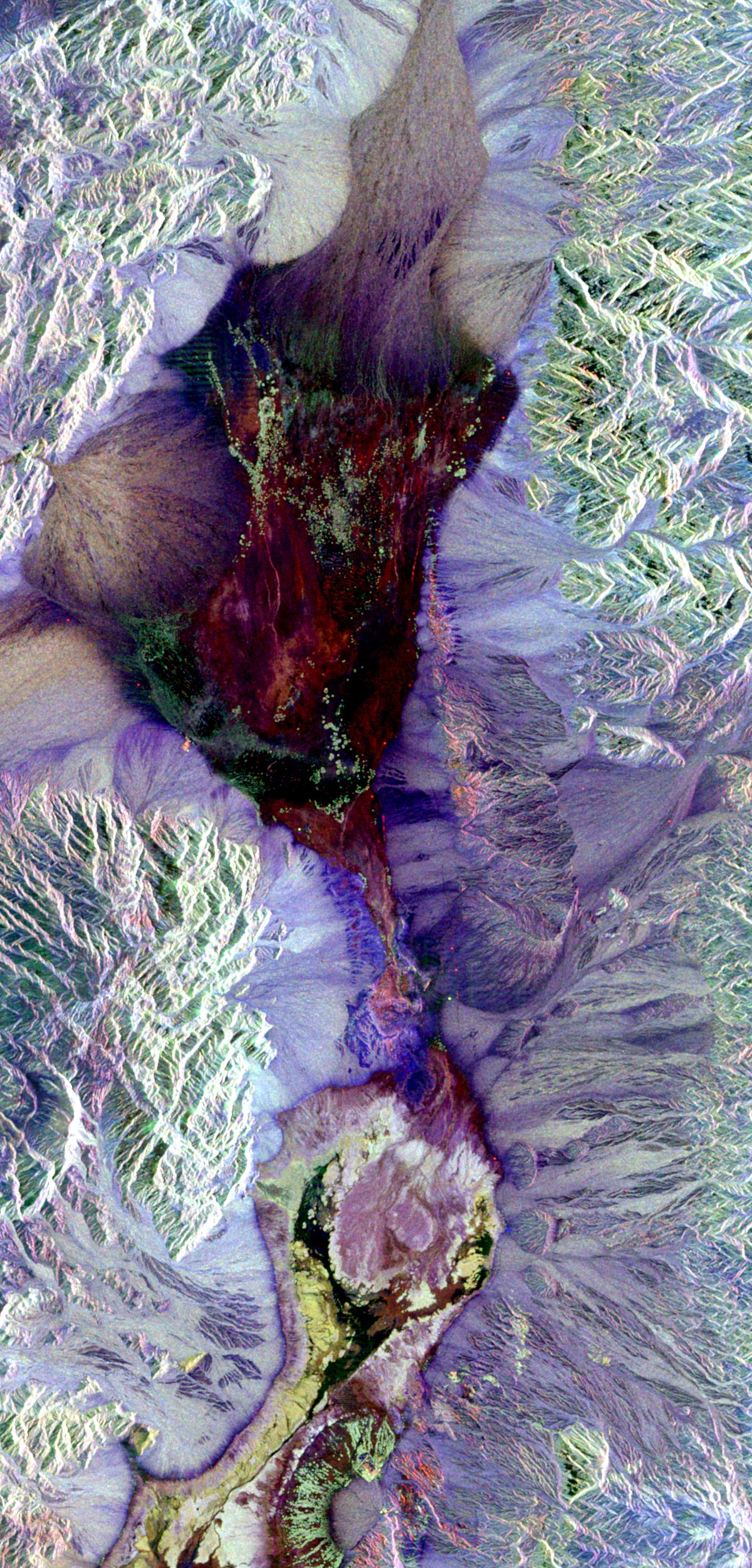
Remote sensing
Remote sensing is the acquisition of information about an object or phenomenon without making physical contact with the object, in contrast to in situ or on-site observation. The term is applied especially to acquiring information about Earth and other planets. Remote sensing is used in numerous fields, including geophysics, geography, land surveying and most Earth…
-
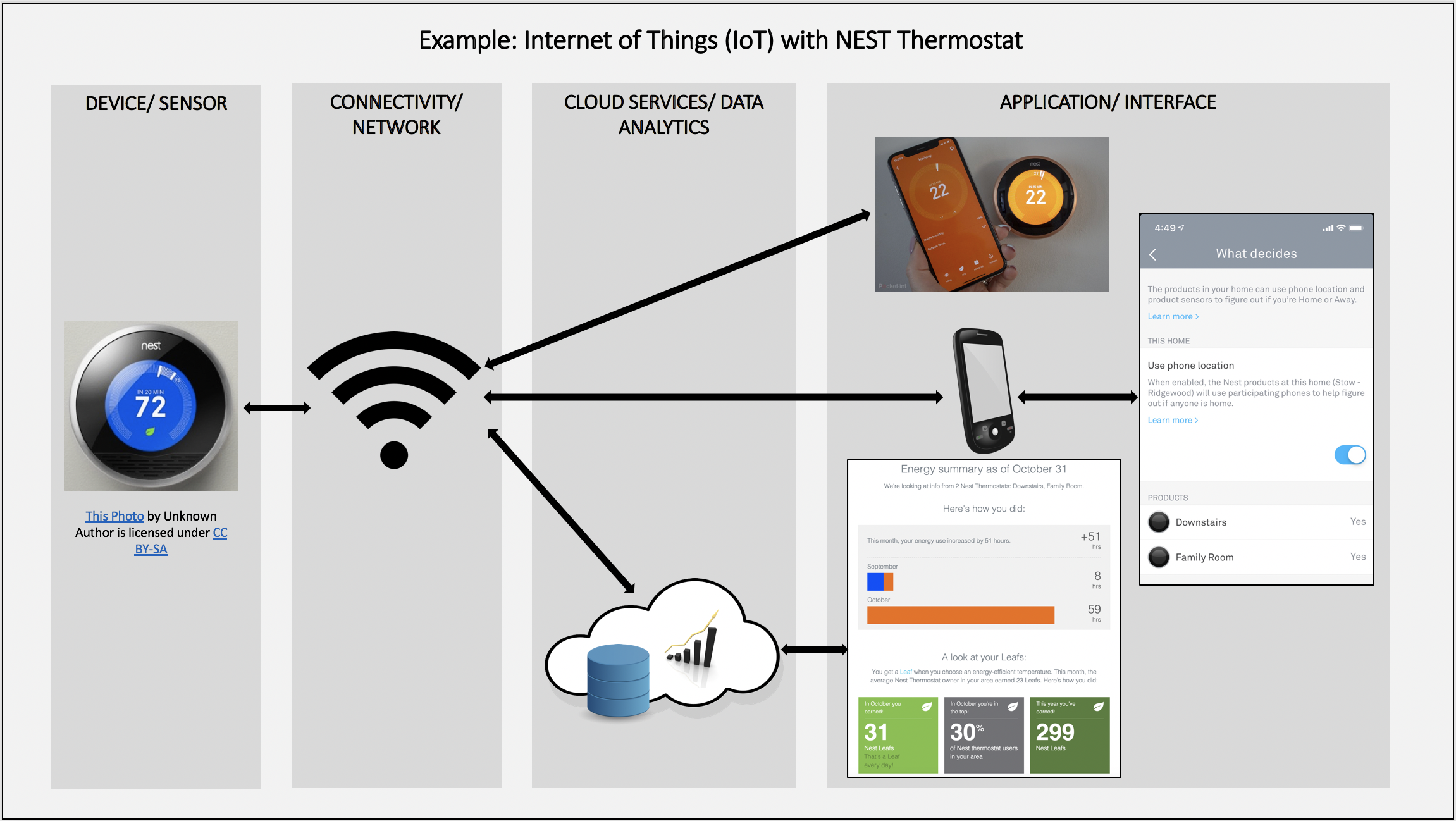
Geographic information system
A geographic information system (GIS) consists of integrated computer hardware and software that store, manage, analyze, edit, output, and visualize geographic data. Much of this often happens within a spatial database; however, this is not essential to meet the definition of a GIS. In a broader sense, one may consider such a system also to…
AI & Data
-
Natural language processing
Natural language processing (NLP) is the processing of natural language information by a computer. NLP is a subfield of computer science and is closely associated with artificial intelligence. NLP is also related to information retrieval, knowledge representation, computational linguistics, and linguistics more broadly. Major processing tasks in an NLP system include: speech recognition, text classification,…
-
Large language model
A large language model (LLM) is a language model trained with self-supervised machine learning on a vast amount of text, designed for natural language processing tasks, especially language generation. The largest and most capable LLMs are generative pre-trained transformers (GPTs) and provide the core capabilities of modern chatbots. LLMs can be fine-tuned for specific tasks…
-
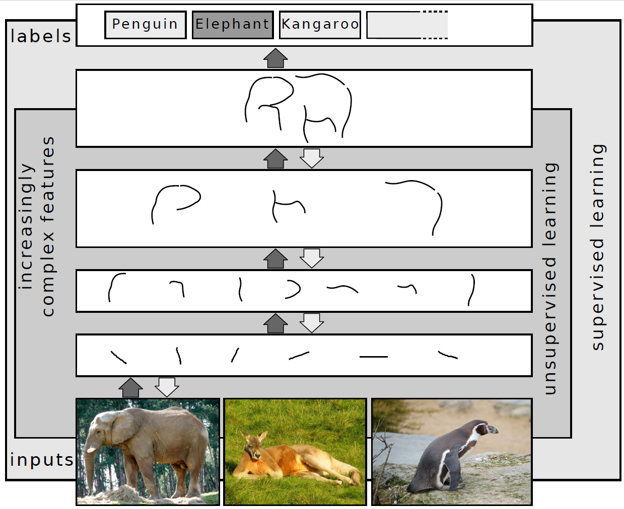
Deep learning
In machine learning, deep learning focuses on utilizing multilayered neural networks to perform tasks such as classification, regression, and representation learning. The field takes inspiration from biological neuroscience and revolves around stacking artificial neurons into layers and “training” them to process data. The adjective “deep” refers to the use of multiple layers (ranging from three…